

Saildrone: Data on the high seas
Published on May 31st, 2024
It was 2013 when Saildrone’s unmanned, autonomous vessel set records by sailing from San Francisco to Kaneohe, Hawaii, and has since covered more than a million nautical miles delivering observations and insights about activity above and below the ocean surface. That kind of success finds Saildrone on the Time Magazine list as one of the 100 most influential companies in 2024:
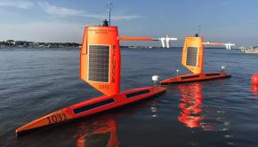
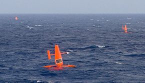
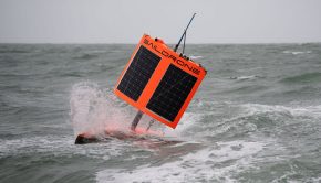
At any given time, there may be 50 of Saildrone’s unmanned surface vehicles (USVs) sailing the world’s seas. Powered mostly by wind and solar energy, the USVs—which do, in fact, look like small robotic sailboats—are packed with sensors gathering atmospheric and ocean data for everything from measuring dangerous weather events to saving the whales (from harm by ships and construction), and can stay unattended for up to a year.
The company’s “maritime domain awareness” customers—those involved in law enforcement, including the U.S. military—use its data to track illegal fishing, drug smuggling, and human trafficking. “We do a bit of everything, and you can often do many things at the same time,” says CEO Richard Jenkins, who started the company after adapting a design he’d used to break the wind-powered land-speed record (126.2 mph) in 2009.
Last year, Saildrone partnered with Seabed 2030, a project to map the entire ocean floor, which will be helpful for climate models, tsunami forecasting, and cable and pipeline routing.


Related Posts
VIDEO: A view from inside Hurricane Sam →
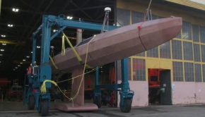
72-foot USV launched in California →
When working at home is the ocean →
 We’ll keep your information safe.