Boundaries defined for Southern Ocean
Published on June 13th, 2021
As round the world races turn the corner at the tip of South Africa, ascending into the southern latitudes for strong winds and a more direct course toward the bottom of South America, sailors soon reference the inhospitable conditions of the Southern Ocean.
The only problem was they were rarely in it.
Among the international organizations that define such things, the Southern Ocean was either not recognized at all or there was a general disagreement as to its borders. However, it appears that progress has been made on this issue according to this report by National Geographic:
Those familiar with the Southern Ocean, the body of water encircling Antarctica, know it’s unlike any other.
“Anyone who has been there will struggle to explain what’s so mesmerizing about it, but they’ll all agree that the glaciers are bluer, the air colder, the mountains more intimidating, and the landscapes more captivating than anywhere else you can go,” says Seth Sykora-Bodie, a marine scientist at the National Oceanic and Atmospheric Administration (NOAA) and a National Geographic Explorer.
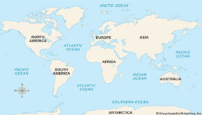
Since National Geographic began making maps in 1915, it has recognized four oceans: the Atlantic, Pacific, Indian, and Arctic Oceans. But starting in 2021 on June 8, World Oceans Day, it will recognize the Southern Ocean as the world’s fifth ocean.
“The Southern Ocean has long been recognized by scientists, but because there was never agreement internationally, we never officially recognized it,” says National Geographic Society Geographer Alex Tait.
Geographers debated whether the waters around Antarctica had enough unique characteristics to deserve their own name, or whether they were simply cold, southern extensions of the Pacific, Atlantic, and Indian Oceans.
“It’s sort of geographic nerdiness in some ways,” Tait says. He and the National Geographic Society’s map policy committee had been considering the change for years, watching as scientists and the press increasingly used the term Southern Ocean.
The change, he adds, aligns with the Society’s initiative to conserve the world’s oceans, focusing public awareness onto a region in particular need of a conservation spotlight.
“We’ve always labeled it, but we labeled it slightly differently [than other oceans],” Tait says. “This change was taking the last step and saying we want to recognize it because of its ecological separation.”
Marine biologist and National Geographic Explorer at Large Sylvia Earle praised the cartographic update.
“While there is but one interconnected ocean, bravo to National Geographic for officially recognizing the body of water surrounding Antarctica as the Southern Ocean,” Earle wrote in an e-mailed statement.
“Rimmed by the formidably swift Antarctic Circumpolar Current, it is the only ocean to touch three others and to completely embrace a continent rather than being embraced by them.”
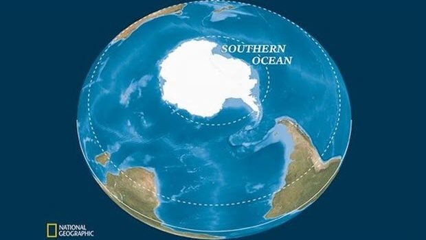
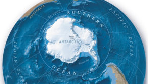
National Geographic now recognizes five world oceans. Most of the waters that surround Antarctica out to 60 degrees south latitude, excluding the Drake Passage and Scotia Sea, constitute the newly acknowledged Southern Ocean.
But while the other oceans are defined by the continents that fence them in, the Southern Ocean is defined by a current.
Scientists estimate that the Antarctic Circumpolar Current (ACC) was established roughly 34 million years ago, when Antarctica separated from South America. That allowed for the unimpeded flow of water around the bottom of the Earth.
The ACC flows from west to east around Antarctica, in a broad fluctuating band roughly centered around a latitude of 60 degrees south—the line that is now defined as the northern boundary of the Southern Ocean. Inside the ACC, the waters are colder and slightly less salty than ocean waters to the north.
Extending from the surface to the ocean floor, the ACC transports more water than any other ocean current. It pulls in waters from the Atlantic, Pacific, and Indian Oceans, helping drive a global circulation system known as the conveyor belt, which transports heat around the planet. Cold, dense water that sinks to the ocean floor off Antarctica also helps store carbon in the deep ocean. In both those ways, the Southern Ocean has a crucial impact on Earth’s climate.
Scientists are currently studying how human-driven climate change is altering the Southern Ocean. Ocean water moving through the ACC is warming, scientists have learned, but it’s unclear how much this is impacting Antarctica. Some of the most rapid melting of the continents ice sheets and shelves have been where the ACC is closest to land.
For now, by fencing in the frigid southern waters, the ACC helps keep Antarctica cold and the Southern Ocean ecologically distinct. Thousands of species live there and nowhere else.
The Southern Ocean “encompasses unique and fragile marine ecosystems that are home to wonderful marine life such as whales, penguins, and seals,” notes National Geographic Explorer in Residence Enric Sala.
What’s more, the Southern Ocean has ecological effects elsewhere as well. Humpback whales, for example, feed on krill off Antarctica and migrate far north to winter in very different ecosystems off South and Central America. Some seabirds migrate in and out too.
By drawing attention to the Southern Ocean, the National Geographic Society hopes to promote its conservation.
The impacts of industrial fishing on species like krill and Patagonian toothfish (which is marketed as Chilean sea bass) has been a concern in the Southern Ocean for decades. In 1982, catch limits were imposed in the region. The largest marine protected area (MPA) in the world was established in the Ross Sea off West Antarctica in 2016. A number of organizations are working to set aside more MPAs to protect the Southern Ocean’s most critical feeding grounds, for example off the Antarctic Peninsula.
“Many nations across the world support the protection of some of these areas from industrial fishing,” Sala says.
Since the late 1970s, the National Geographic Society has employed a geographer who oversees changes and tweaks to every map that’s published. Tait has been on the job since 2016.
He says he takes a journalist’s approach to the process. It involves staying on top of current events and monitoring who controls what areas of the world.
“It is important to note it’s a map policy, not a policy about Nat Geo’s position on [geopolitical] disputes,” he says. For example, National Geographic maps show that the U.K. controls the Falkland Islands, even though Argentina claims them too. In disputed areas, Tait works with a team of geographers and editors to determine what most accurately represents a given region.
Minor changes happen on a weekly or biweekly basis. Major changes, like labeling the Southern Ocean, are more rare.
Generally, National Geographic has followed the International Hydrographic Organization (IHO) on marine names. While not directly responsible for determining them, the IHO works with the United Nations Group of Experts on Geographical Names to standardize names on an international scale.
The IHO recognized the Southern Ocean in its 1937 guidelines but repealed that designation in 1953, citing controversy. It has deliberated on the matter since, but has yet to receive full agreement from its members to reinstate the Southern Ocean.
The U.S. Board on Geographic Names, however, has used the name since 1999. And in February of this year, NOAA officially recognized the Southern Ocean as distinct.
Tait says National Geographic’s new policy will have an impact on how children using maps in school learn to see the world.
“I think one of the biggest impacts is through education,” he says. “Students learn information about the ocean world through what oceans you’re studying. If you don’t include the Southern Ocean then you don’t learn the specifics of it and how important it is.”


 We’ll keep your information safe.